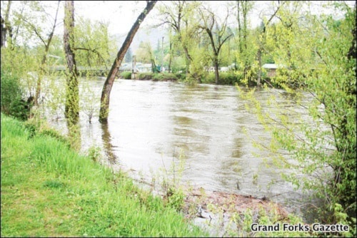
With the Kettle and Granby rivers rising with seasonal run-off, dangers of flooding become more apparent.
Dan Derby, emergency program co-ordinator for the Regional District of Kootenay Boundary (RDKB), said that it is preparing for flooding, doing an inventory and ordering more sand bags.
“We’ve been monitoring river levels and the weather across the regional district,” Derby said. “We have sand bags on hand in many of the communities across the regional district.”
The RDKB is also developing base maps, which include flood plain and other pertinent data to assist them if the water levels continue to rise.
Derby said they are co-ordinating and monitoring with other entities, such as Emergency Management B.C. and Ministry of Transportation and Highways’ Water Stewardship Branch. The city is also included in the emergency program.
They are also setting up and testing their emergency operations centre infrastructure and reviewing and updating contingency planning. The centres are located in Trail and Grand Forks, and would co-ordinate out of the centre closer to the flooding.
He said that since the Kettle in particular has been coming up faster than locals expected, there have been a lot of requests for sand bags.
He said that with flooding, the high snow pack is only one of the pieces. It also depends on temperatures and weather, like rain.
“Flooding is a tough one, because you never know when the crest is over but I think it’s safe to say that there’s a heightened level of monitoring going on, and that’s going to continue through the end of this month and probably well into June,” he said.
“We’re going to continue to assist affected residents until it’s over.”